


SityTrail - Le Luc Mascaronne rando

affinetataille
User GUIDE


5h30
Difficulty : Easy

FREE GPS app for hiking
 SityTrail
IGN / Geographical institutes
SityTrail Plus
The world is yours!
About
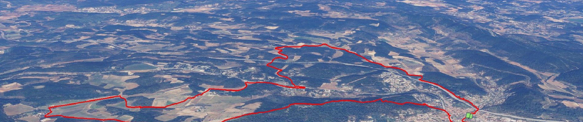
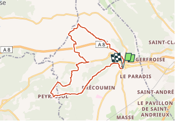
Trail Walking of 17.4 km to be discovered at Provence-Alpes-Côte d'Azur, Var, Le Luc. This trail is proposed by affinetataille.
Description
01-03-17 Guide : Fernand
Rando de restons en Forme Draguignan.
22 au départ " et à l'arrivée", Beau temps, un peu froid et venteux le matin mais super par la suite.
pic nic au soleil à La Bernade en 225.
Visite du patrimoine Lucois au retour, avec en particulier la tour hexagonal de l'OT.
Photos


29 photos in total. Please click on a photo to see them all in the gallery.
Positioning
Comments